


Mining Plan Suite is a browser-based application designed for open-pit mine planning, bench design, surface analysis, and volume estimation. It allows users to work directly on geospatial data to visualize terrain, plan bench cuts, compute volumes, and analyze mining progress — all without installing specialized desktop software.
In mining plans, reserve estimation is traditionally carried out using cross-sectional area methods. While widely used, these methods can sometimes lead to overestimation or underestimation of mineable reserves. When reserves are overestimated, mine owners may be required to pay excess royalty, resulting in financial burden. Conversely, when reserves are underestimated, the government may lose legitimate revenue. Both situations highlight the need for more reliable and transparent reserve estimation methods.
This tool is intended primarily for geologists and mining engineers engaged in mining operations and regulatory compliance. Access to the application is restricted to registered users. Those requiring access may contact the developer, Biju Sebastian, at theminemapper@gmail.com for registration.
The foundation of Mine Mapper Suite is its ability to work directly from mine boundary pillar coordinates. Once boundary data is provided, the application establishes the mining lease limits and prepares the spatial framework required for further analysis.
|
|
|
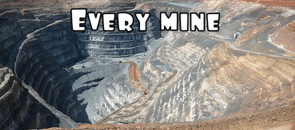
Mine boundary and no mining zone |

3. Terrain Generation Using LiDAR or SRTM Data
This flexibility allows users to perform mine planning and reserve estimation even in data-limited environments.
|
|
|
Option to choose elevation data source
|

|
|
|
Topographic Map |

4. Bench Design and Mining Simulation
Mining Plan Suite simulates the mining process through controlled bench cutting. Users specify parameters such as bench height and starting elevation, after which the software performs top slicing followed by sequential bench development. Each bench is generated step by step, reflecting realistic mining operations.
The system automatically stops bench cutting when the ultimate pit limit is reached, ensuring that mining remains within feasible and defined limits.
|
|
|
Selection of bench cutting parameters |

 |
| Bench Map |
These profiles are useful for understanding slope behavior, bench design integrity, and overall mine geometry.
|
|
|
Cross Section |

|
|
|
Option to draw cross sections |

6. Three-Dimensional Visualization
Mining Plan Suite includes a 3D visualization module that allows users to view the mine in three modes: Original Surface, Bench Surface, and Original Surface with Benches. Adjustable vertical exaggeration and interactive camera controls make it easier to interpret terrain and bench development.
|
|
|
3D View -Bench Surface |

|
|
|
3D View - Original Surface |

|
|
|
3D View-Original and Bench Surface |

7. Contour Map and Surface Visualization
|
|
|
Contour Map |

8. Reserve Estimation: Geological & Mineable
Where applicable, soil or overburden parameters can be incorporated to support more realistic reserve calculations. All results are presented in structured tables suitable for technical evaluation and reporting.
|
|
|
Bench wise mineable reserve calculation |

|
|
|
Bench wise volume computation of overburden |

|
|
|
Bench floor area computation |


9. Report Generation in PDF Format

10. GPS-Based Location and Elevation Tracking (Mobile/Tablet Support)
The user’s current ground position is displayed simultaneously on both the Topographic Map and the Bench (Mining Plan) Map. The system automatically fetches and displays the elevation at the user’s location from the active surface.
This feature is particularly useful for site inspections, ground truth verification, and on-site decision-making, bridging the gap between digital mine planning and real-world field conditions.
 |
| GPS based location and elevation tracking |
11. Conclusion
Mining Plan Suite demonstrates that effective mine planning and reserve estimation do not require complex inputs or expensive desktop software. Starting from simple boundary pillar data, the application delivers surface modeling, bench simulation, volume computation, profiles, and 3D visualization in a single integrated workflow. This makes it a practical and reliable solution for modern open pit mine planning.
Steps for Operating the Mining Plan Suite
1. User Registration
Contact the developer and register by providing a valid email ID.
2. Login
Log in using the registered email ID and the One-Time Password (OTP) received in the email.
3. Select Elevation Data Source
Choose the source of elevation data.
· By default, SRTM elevation data (30 m resolution, year 2000) is selected.
4. Select LiDAR Option (If Available)
If LiDAR data is available, select the LiDAR elevation data option.
5. Upload LiDAR DEM File
Upload the LiDAR Digital Elevation Model (DEM) file.
6. Upload Mining Boundary File
Upload the boundary file.
(The boundary file can be generated using Mine Mapper App, KOMPAS App, or similar applications.)
7. Map Visualization
After uploading the required files, the following maps will be displayed:
· Topographic Map
· Mining Plan (Bench) Map
8. Measurement and Profile Tools
Tools are available in both maps for:
· Distance measurement
· Drawing elevation profiles
9. Enter Bench Design Parameters
Provide the required bench and material parameters:
· Mine name
· Mineral name
· Bench width
· Bench height
· Thickness of soil
· Specific gravity of mineral
· Specific gravity of soil
· (Optional) Maximum number of benches to be limited
10. Initialize Bench Cutting
Click the Initialize Bench Cutting button to prepare the model for bench excavation.
11. Cut Benches
Click the Cut Benches button.
· The system first checks for the feasibility of top slicing.
· If feasible, top slicing is carried out initially.
· Subsequent benches are then cut as per the specified bench parameters.
12. Volume and Weight Calculation
After each bench is cut, the following details are automatically calculated and displayed:
· Volume and weight of mineral (ore)
· Volume and weight of overburden (soil)
13. Section Drawing
There is a provision to draw cross-sections in the bench map for detailed sectional analysis.
14. 3D Visualization of Benches
After section drawing, a 3D visualization of the mining area and benches is generated.
15. 3D Visualization Tools and Controls
The 3D module provides multiple interactive tools, including:
· Viewing original surface, bench surface, or both surfaces together
· Displaying contour maps in 3D
· Rotation of the 3D model in all directions
· Zoom in and zoom out controls
· Pan and view reset options
· Vertical exaggeration control for enhanced interpretation
· Ability to toggle visibility of different surfaces and layers
16. Interactive Analysis in 3D View
The 3D environment allows users to visually assess:
· Bench geometry and continuity
· Overall pit development
· Relative position of benches with respect to the original terrain
17. Report Generation
Finally, a provision is available to generate a comprehensive PDF report containing:
· Input parameters
· Bench-wise volume and weight details
· Sections and 3D visualizations
Disclaimer and Terms of Use
Mining Plan Suite is provided as a technical decision-support tool to assist in mine planning and reserve estimation. While every effort has been made to ensure the accuracy and reliability of the computations and visualizations, the results generated by this application are indicative in nature and may be subject to errors arising from data quality, input assumptions, resolution of elevation models, or inherent limitations of computational methods.
The developer does not guarantee the completeness, accuracy, or suitability of the outputs for any specific purpose. Users are advised to independently verify all results using approved survey methods and professional judgment before adopting them for statutory, financial, or operational decisions. The developer shall not be held responsible or liable for any loss, damage, financial implication, or legal consequence arising directly or indirectly from the use of this application or reliance on its outputs.
This tool is intended for non-commercial, technical, and academic use only. Unauthorized commercial use is not permitted. By accessing or using this application, users acknowledge and accept these terms and conditions.


0 Comments